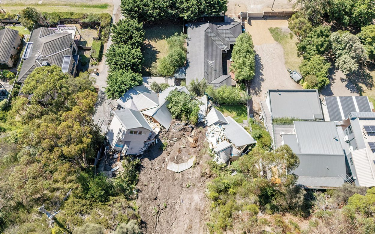
MORNINGTON Peninsula Shire councillors have voted to advance an interim erosion management overlay, a planning control aimed at managing development on land most prone to landslides.
The decision was made during the shire’s unscheduled public meeting on 17 November following an urgent directive from state Planning Minister Sonya Kilkenny to prepare an amendment to the Mornington Peninsula planning scheme that would form the new control.
The measure was a key recommendation of the board of inquiry into the McCrae landslide in January that saw a house slide down the escarpment, which was found later to have been caused by a burst water main, according to the inquiry’s September report.
The overlay is intended to cover areas classified as highly susceptible to landslide that are not already subject to existing erosion overlays.
The planning control will now be considered for approval by the Planning Minister.
If applied to a property, the new planning rule would generally require owners to obtain a planning permit before undertaking most forms of development. This may include vegetation removal, drainage changes or other works that could influence land stability.
According to the council, many applications would also need to be supported by a report from a qualified geotechnical specialist outlining how any proposed works can be undertaken safely.
But the shire will have the discretion to scale back or vary the requirements “if they are not relevant to the assessment of an application”.
About seven per cent of the shire’s total land area falls into the “high susceptibility” category – around 33,000 lots, with roughly 27,000 of them residential.
For many landholders, only a portion of their property is expected to fall within the overlay area, meaning “development can occur in the usual way on that part of the site not covered by the new overlay, subject to any other relevant planning controls that apply to the land,” the shire stated.
The new overlay would be temporary and is expected to remain in place while the shire completes a detailed, municipality-wide update of landslide mapping and risk data.
That body of work, along with the full amendment process for permanent planning controls, is expected to take between two and four years.
Mayor Cr Anthony Marsh said the shire’s priority was to keep the community safe, noting “this interim control will help minimise the risks posed by development on landslide susceptible land”.
“While an erosion management overlay would not have prevented the McCrae landslide, which was caused by a burst water main, it was a recommendation of the board of inquiry. Council has accepted the inquiry’s recommendations in relation to implementing the erosion management overlay,” he said.
According to a shire report, the interim overlay is guided by the landslide susceptibility assessment, which divides the municipality into low, medium, and high landslide-risk categories.
This assessment has long informed when geotechnical reports are needed for planning applications, and under the proposed overlay, most buildings and works would require a permit supported by technical advice showing how a proposal keeps “landslide risks to property and life to within tolerable levels.”
Because the overlay affects thousands of homes and lots, the planning amendment includes exemptions for minor works and gives planners the ability to vary or waive requirements to avoid unnecessary red tape.
The shire’s report also said the amendment also “ensures landslide risks can be appropriately considered in planning applications following recent reforms to Victoria’s planning system, and related decisions from the Victorian Civil and Administrative Tribunal, which effectively prevent consideration of environmental risks unless a relevant planning control is in place”.
First published in the Mornington News – 25 November 2025


