

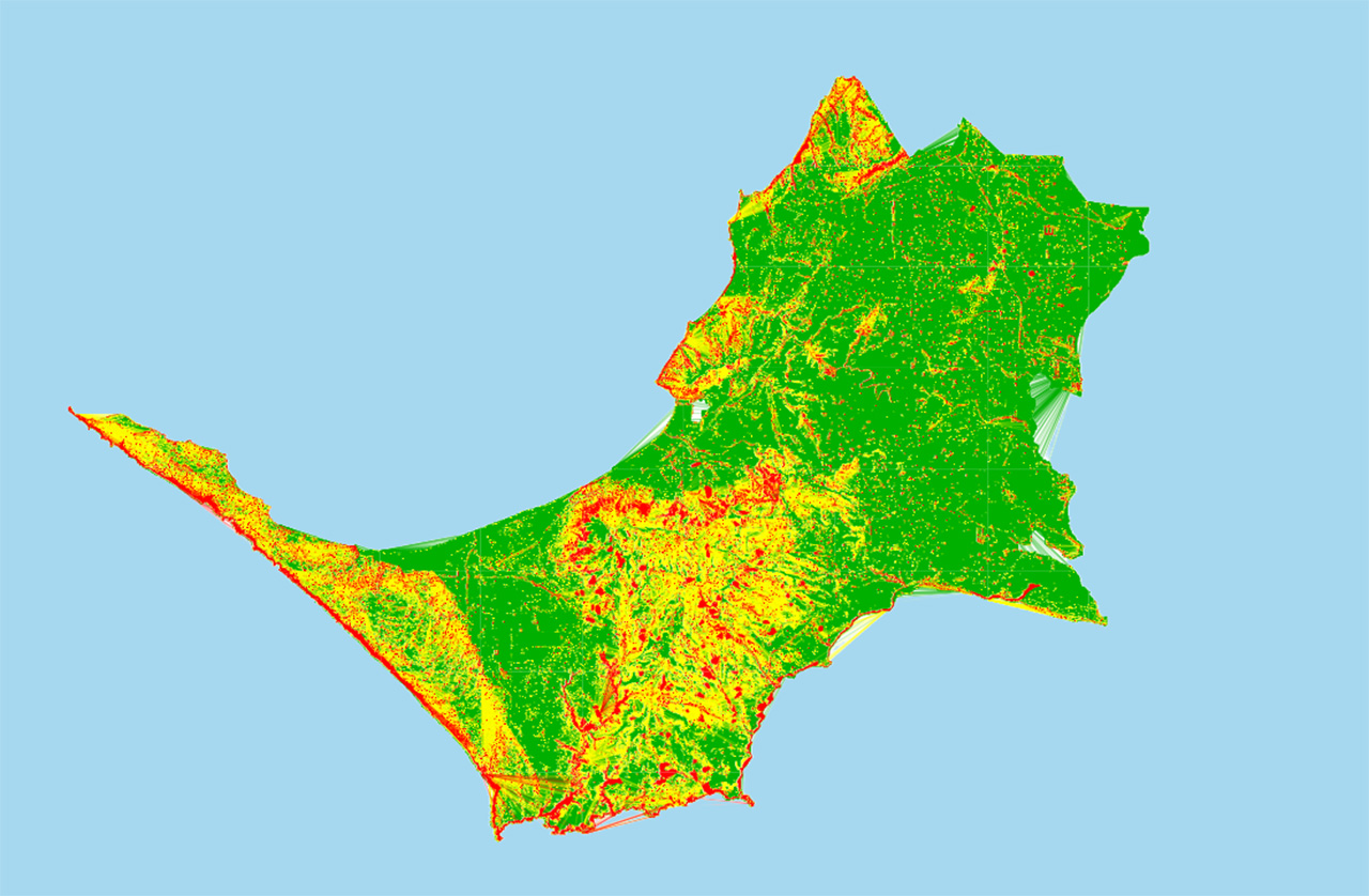
MORNINGTON Peninsula Shire will consider asking the state government to drastically reduce the interim landslide planning controls introduced in response to a recommendation from the McCrae landslide board of inquiry.
At the 11 August council meeting, councillors will decide whether to write to Planning Minister Sonya Kilkenny requesting amendments to the Interim Erosion Management Overlay (EMO7).
If adopted, it would reduce the number of affected properties from 33,000 to around 6,000.
The changes would bring the peninsula’s total land area covered by the overlay down to around 5.5 per cent, with 40 per cent being public land.
The recommendation follows months of community backlash following the introduction of the overlay last last year.
Many residents argued their properties had been incorrectly classified as highly susceptible to landslides.
The shire said while EMO7 was based on the best available information at the time, they have since completed an updated review using expert advice, updated LiDAR data, and site inspections.
The shire previously confirmed EMO7 was a temporary measure until a revised EMO was completed “after a comprehensive shire-wide review of landslide susceptibility data and mapping (also known as Stage 3 of council’s review and update of EMOs on the peninsula)”.
The proposed changes mark a significant shift from the original interim overlay, which was introduced following the findings of the board of inquiry into the January 2025 McCrae landslide.
The overlay was the subject of widespread criticism, with The News being told properties containing features such as small retaining walls, flat residential streets, piles of garden waste, and otherwise level land had been captured by the mapping.
Following the introduction of the overlay, the shire acknowledged flaws in the data used.
“We are aware of some anomalies in the mapping used for the interim erosion management overlay,” the shire said at the time.
“For example, retaining walls and other minor earthworks with an artificially steep slope have been picked up as being highly susceptible to landslides.”
The shire said it was “working to remove these anomalies as a matter of priority” before asking the Planning Minister to revise EMO7 to reflect the updated mapping.
Mornington MP Chris Crewther previously said it was disappointing the state government requested an interim overlay based on 2012 mapping and then approved the overlay.
“This means 33,000 properties impacted, including properties deemed as highly susceptible to landslide risk that only have small retaining walls, piles of debris, basically flat land, and more,” said Crewther.
At the time, he said he was “hopeful that council can finalise an updated and accurate erosion overlay as soon as possible, keeping only properties actually susceptible to landslide”.
The latest proposal appears to deliver on this commitment, reducing the number of affected properties by more than 80 per cent.
The review also comes after questions were raised over the state government’s role in the overlay’s introduction.
Earlier this year, Kilkenny told Parliament the shire had “requested that I introduce an interim Erosion Management Overlay to land identified as highly susceptible landslide”.
However, a letter obtained by The News showed the minister had previously directed the council to begin implementing the overlay within 14 days of the board of inquiry report being tabled.
“I request that your council act on recommendation 27 [of the Board of Inquiry report] to urgently implement an interim EMO and to commence this process by 23 October 2025, 14 days from the tabling of the report,” the letter stated.
In the letter, Kilkenny said the overlay would apply to “land identified as highly susceptible to landslides in 2012 mapping and any additional area recommended by geotechnical engineers engaged by your council”.
She also said if council did not proceed, she would consider “intervening using powers available to me under the Planning and Environment Act 1987”.
In December, councillors passed an urgent motion following community concern. They acknowledged frustrations and called on the state government to accelerate a review of the “data errors” and mapping accuracy.
At the 16 December council meeting, Cr Bruce Ranken said community anxiety had intensified, with “many landowners report[ing] receiving notice of overlay applications on land they consider flat or not at risk, raising concerns around the methodology of mapping and the accuracy of the underlying data”.
If councillors endorse the reviewed mapping, the shire will formally ask the Planning Minister to amend EMO7, reducing the number of affected properties.
First published in the Mornington News – 11 August 2026
