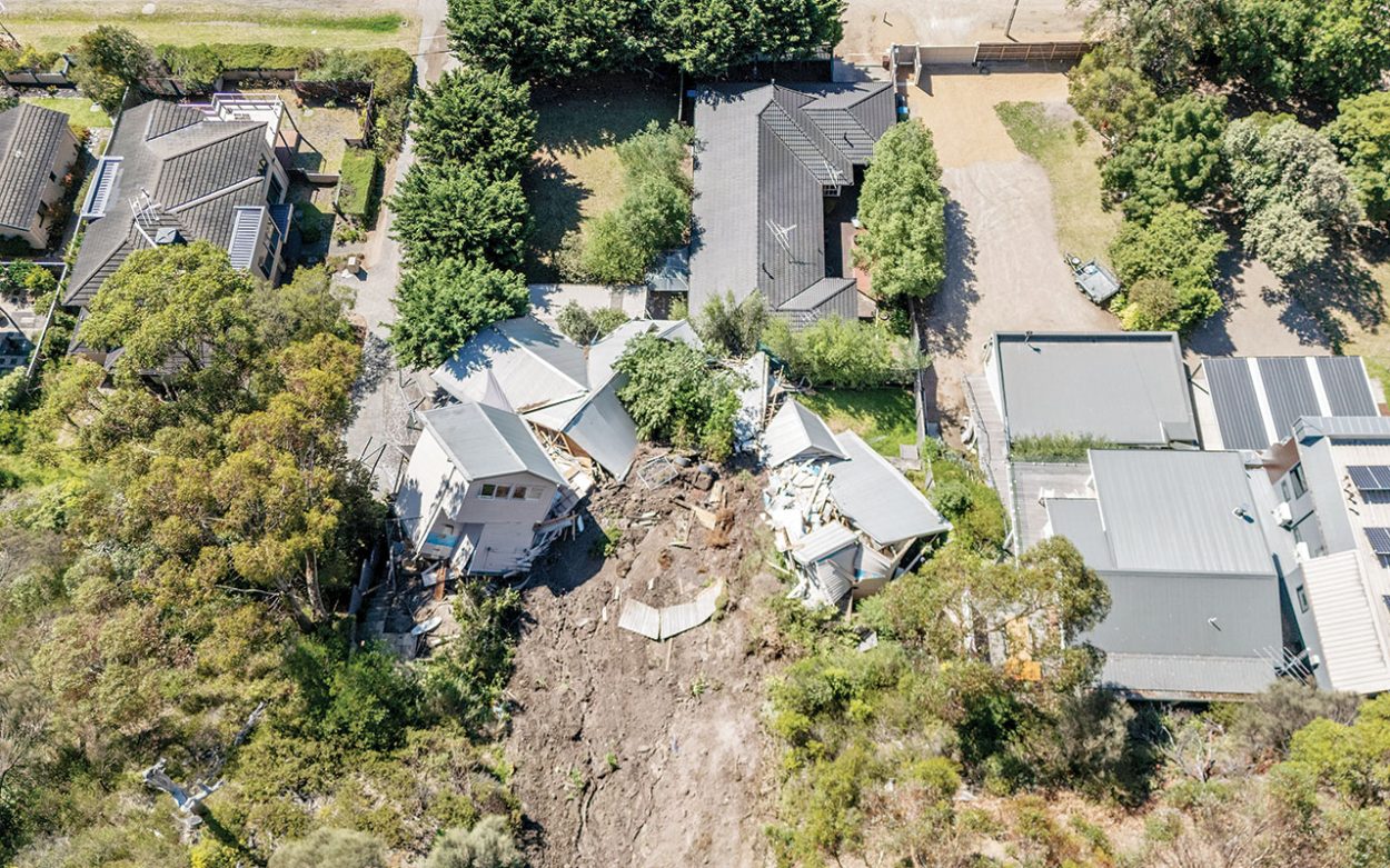
MORNINGTON Peninsula Shire councillors have backed new measures to improve landslide and erosion management, including public access to data and stronger planning controls in high-risk areas.
At their 14 October council meeting, councillors unanimously voted to introduce an interim Erosion Management Overlay (EMO) across high-risk parts of the Mornington Peninsula. An EMO is a planning control that identifies land vulnerable to erosion or landslides, allowing the shire to enforce stronger regulations on development to protect safety and stability.
As part of the new measures, the shire would make landslide susceptibility data from its Landslide Susceptibility Assessment publicly available. The move will help residents, developers, and community groups better understand risks and make informed decisions about land use.
As part of the approved motion, council will make existing landslide susceptibility data from the Landslide Susceptibility Assessment, which is currently only available on the shire’s internal system, public. A page will be established on the shire’s website which will have information for residents on whether their properties could be affected and provide updates on how the council is addressing erosion and landslide risks.
The shire currently has six EMOs in the Mornington Peninsula Planning Scheme (MPPS), but these do not cover all areas prone to erosion or landslides. Updated landslide mapping is a process expected to take up to four years, so council will request the Minister of Planning to approve an interim EMO by the end of 2025.
This overlay would apply to all high-risk landslide areas highlighted in the shire’s existing data. Further expansion of the EMO is expected in early 2026 following advice from engineering and environmental consultants Stantec.
Cr Bruce Ranken said the proposal and EMOs were not about making life harder for property owners, but about improving clarity and transparency. “I want to be clear that I’m not an advocate for unnecessary red tape regulations that unfairly burden property owners. What it is about is simplicity, certainty, and transparency,” Ranken said.
“We all know overlays can be confusing and intimidating especially for residents that are unfamiliar with planning jargon or the processes, but here’s the simple reality. Some parts of our shire are at real risk of landslides and erosions and right now our existing EMOs don’t cover all of these areas.”
This decision comes following the landslide which occurred in McCrae in January and the board of inquiry’s recent report findings and recommendations to the shire (Inquiry finds burst water main caused McCrae landslide, The News 10/10/25).
“As the mayor said in his statement last week the shire is welcomed the recommendations of that inquiry, and we are committed to acting upon them as soon as practically possible,” Ranken said at the meeting.
Benbenjie Ward councillor, Max Patton, also acknowledged the community’s ongoing hardship.
“The last year, and in some cases years, has been incredibly hard for residents with a lot of uncertainty, displacement and stress,” Patton said. “I just want to acknowledge what they’ve endured and assure them that their situation remains front of mind as we work through these next steps coming out of the board of inquiry report.”
Patton praised council officers for their swift action and said the measures were an important step in improving the peninsula’s planning and safety. “Tonight’s report shows that this work is well advanced. It’s making our erosion mapping more accurate and up-to-date and applying further planning controls in the places that need them the most. It’s an important step in protecting our community and improving how we plan for the future,” he said.
A council officer confirmed a project control group has been established who will oversee all investigations and reporting and will ensure there is a “coordinated and comprehensive response” to the different issues that have arisen. Council also agreed to advocate to the state government to make changes to planning and building systems to help better address landslide and erosion risks.
A letter will be written to the Housing and Building Minister and the Planning Minister requesting changes to the Building Act 1993 and Building Regulations 2018 to more effectively manage landslide and erosion susceptibility. The council will express concern over the impact of the Townhouse and Low-Rise Code which have changed council’s ability to consider known environmental risks which are not included in the MPPS.
Cr David Gill expressed concerns over these changes and the impact they may have. “The inability of council to consider known risk could have significant implications for the safety of land use and development outcomes,” said Gill. Until broader changes are made, council will advocate for interim changes to the MPPS which will allow councils to consider known environmental risks when assessing planning applications.
The letter will also urge the minister to establish a new, more efficient method for introducing flood and erosion related overlays in planning schemes. This would help ensure the best available data can be translated into appropriate planning controls in a timely manner.
The motion, moved by Patton and seconded by Cr Stephen Batty, was supported by all councillors present at the meeting. “The recommendation is not about adding barriers, it’s about making existing information public, providing clear guidance to residents and developers, and ensuring our planners can make informed consistent decisions,” Ranken said.
First published in the Mornington News – 28 October 2025


